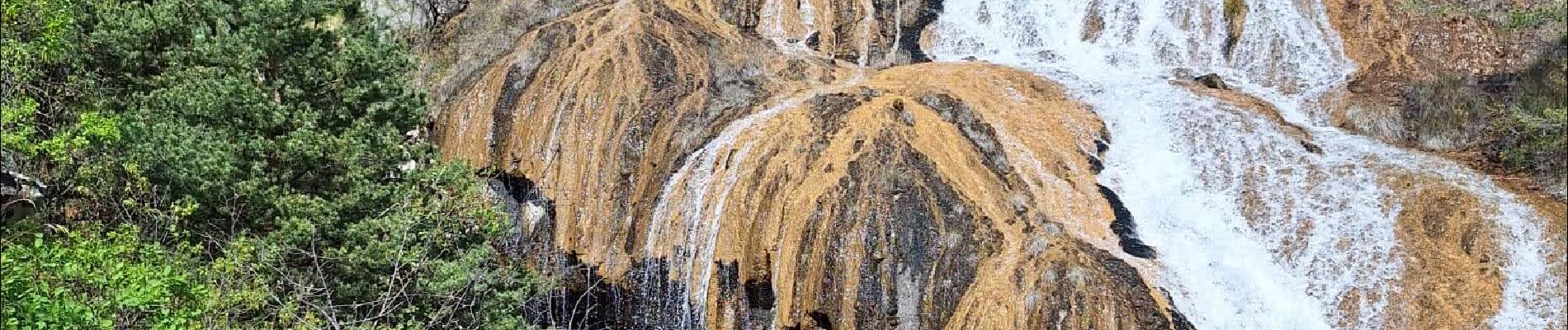
Les Cascades de Costeplane

HG74250
User
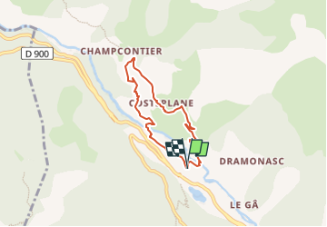

Length
5.7 km

Max alt
1097 m

Uphill gradient
276 m
Km-Effort
9.3 km

Min alt
859 m

Downhill gradient
276 m
Boucle
Yes
Creation date :
2024-05-13 09:43:35.012
Updated on :
2024-05-13 09:55:33.514
2h07
Difficulty : Medium

FREE GPS app for hiking
 SityTrail
IGN / Geographical institutes
SityTrail Plus
The world is yours!
About
Trail Walking of 5.7 km to be discovered at Provence-Alpes-Côte d'Azur, Alpes-de-Haute-Provence, Le Lauzet-Ubaye. This trail is proposed by HG74250.
Photos


Positioning
Country:
France
Region :
Provence-Alpes-Côte d'Azur
Department/Province :
Alpes-de-Haute-Provence
Municipality :
Le Lauzet-Ubaye
Location:
Unknown
Start:(Dec)
Start:(UTM)
295601 ; 4922935 (32T) N.
Comments